
 (All right – the final chapter in the book which will be released in November. In another week or so, I’ll set up a page for pre-orders. This is the story concerting Sophia Brewer Teague, who came west as a Harvey Girl in 1885, and made some startling discoveries about herself … and about some long-buried family secrets. But just as she discovers the one even more startling than her older brother trying to drive her mad … she is caught in Galveston, Texas, on a certain fateful weekend…)
Chapter 23 – Sunrise in Lyonesse
With Min clinging to her side, Sophia went to tend to Baby – relieved to find little Christian no more than moderately fussy, laying in a cradle moved to the corner of the elder Richter’s palatial bedroom. She cuddled him close to her, almost crying in relief, for now they were all three safe, dry and together. Christian nursed with vigor, and fell asleep in her arms, while outside the wind howled like a wolf, striking the side of the house seemingly in fury at being balked and refused admittance. The few candles that relieved the darkness flickered and smoked behind glass chimneys – of course, a careful housekeeper like Amelie would worry about a lit candle falling, and perhaps setting a fire. The bedroom door stood partway open, to the tramping of feet on the stairs and in the hallway as the men carried furniture, and rolled-up rugs upstairs.
“The water is still rising, Sopherl,” Amelie said, when she brought in a mantel clock and an elaborate arrangement of wax flowers under a dome which had formerly adorned the parlor. “We have sent everyone to shelter on the second floor, on the side away from the wind.” The house – with the windows closed and shutters fastened tightly over them – was not only dark, but close and hot. Sophia could see that Amelie’s face shone with perspiration.
“Let me help you, then,” Sophia blurted, overcome with housewifely sympathy. Amelie was a little younger than Mama had been when she died – and had been a gracious hostess all this time. “Min … stay with Baby, and look after him.”
“Mama…” Min protested only with a single word, but her grave little face reflected fear and desolation.
“I will be within the house,” Sophia detached Min’s frantic hand from the skirt of her dress. “There is nothing to fear, darling. We are safe within these walls. Cousin George’s house is the biggest and strongest there is in Galveston.”
“Those houses fell down, Mama,” Min replied. “And the people in them thought they were safe within their walls.”
“Min, dear – I must help Amelie,” Sophia kissed her daughter, and her son, and put on an expression of resolution. “Be brave for me – and for your dear Papa, and for your little brother.”
Min gulped and nodded, her eyes filling. Sophia felt her own eyes welling up with tears that she dare not let fall. It would frighten Min, who was already frightened enough. She followed Amelie; the upstairs was already crowded, mostly with strangers – some of whom seemed to be known to the Richters and their sons, nearly all of them soaking wet, frightened and yet grateful for refuge between sturdy walls. For a wonder, the dreadful howling wind had ceased, and the silence itself was as deafening as the noise had been. Sophia looked into the front hall, from the broad landing halfway down. The downstairs rooms had been stripped of their rugs – and just in time, for there was a pool of water seeping from under the front door, and spreading from other rooms, ink-dark in the light of a single lantern. She caught up to Amelie on the landing, looking down with horror on the invading water. George stood with his arm close around her.
“We have fifty-six people in our house,” she overheard heard him murmur to his wife, in German, in that silence. “And Old Mr. Pascoe with his wife and her niece are coming from their house, which is falling to bits. Ambrose and Young Pascoe have gone to help them across the way. They tell me that wind has dropped.”
“Does it mean that the storm has passed over?” Amelie asked, and George shook his head.
“No … it means that we are now in the center of it.” The knocking on the front door sounded very loud in the silence. George sprang down the staircase with an energy which belied his age and the weariness piled on him by this dreadful day, and unbarred the door to admit the new party; Ambrose, another young man, and the three refugees; the oldest carried among them. “The water is rising,” George observed, and made as if to close and bar the door on the darkness and the driving rain outside, but before he could do so, the tide went in one smooth motion from a puddle at his feet to almost his chest, flowing into the hallway, the parlor and the other rooms. “Upstairs, everyone!” he shouted, as there came the crash of breaking glass and wood from within. Sophia fled up stairs, stumbling in her panic. The storm had breached the final fortress. And now the wind howled around its walls with renewed energy.
She sat at the foot of the Richter’s bedstead, with Christian in her lap, and Min pressed close to her side, with the Teague’s old plaid woolen shawl wrapped around them all. Min had always treasured it as a blanket, since her own babyhood, for some inexplicable reason, and now sought comfort in those rough and scratchy folds. George and Amelie sat at the head of the bed, with Henry and Ambrose beside them, or pacing the crowded room; some of the other refugees from the storm lay on the floor, or leaned against the walls. Candlelight flickered over their tense faces. An old woman – Mrs. Pascoe – lay on Amelie’s chaise longue, her lips moving in a silent desperate prayer. The atmosphere in the room was hot, humid with the scent of terror and desperation, waiting for the storm to break open the brick walls as though breaking an eggshell. Richie sat on the floor at their feet; he alone seemed at ease. The noise of the wind was such that words could not be heard across the room unless shouted. Time stood still, as still as the hands of Amelie’s parlor clock … and yet, the walls of George Richter’s house held; battered by rain, by flying slates and timbers which crashed against the windward walls. A queer kind of thumping came from under their feet; at last, Sophia realized that it must be the remaining furniture downstairs, driven to and fro, dashed against interior walls by the high tide within.
Min fell asleep at last, exhausted; without disturbing the child’s slumber, Sophia laid her daughter across the middle of the bed with Baby Christian and covered them both with the plaid shawl. Silently, Richie took Min’s place. It was comforting to lean against him, to have the support of a man’s shoulder on this terrifying day. Sophia desperately wished that it was Fred’s – but Richie’s would do.
Presently, Sophia ventured, “You know – we would not have been here, but for the delay in your travel plans. We would have been on our way home by now.”
“I know,” Richie answered. “I’m sorry for that, Auntie … it seems like we have been nothing but trouble and danger for you, in every way.”
“No … not you, Richie – never; this storm is just a terrible coincidence. I might just as soon blame myself. I should have been agreeable to corresponding with you. You and I are the only two left. I should not have been so afraid … old habits die hard, you know. I was about to marry Fred. I wanted to leave all of that in the past, where it belonged … but of course that is not possible. The past is not so easily abandoned as all that.”
“No,” Richie sighed. “That is what Rosy said. Professor Rosemont … he was the headmaster at school. Dear old Rosy; he became my guardian after Papa did what he did. A decent old stick; he called me into his office and broke the news to me. About Papa and Mama; I suppose that I blubbed a bit, and asked him where I should go when the term was over, and Rosy handed me a handkerchief and said, ‘To me and Mrs. Rosemont, of course.’ And that was the end of it. Rosy settled it with the lawyers. I did have to say to a judge that I preferred them to be my guardians over any other, but Rosy and Mrs. Rosy turned out to be as fair and good to me as any parent might have been … although Rosy was a bit irate when I enlisted in the Colonel Wood’s volunteer cavalry to fight in Cuba.”
“You were in the Rough Riders?” Sophia exclaimed, quite astonished, and Richie laughed.
“More like the Weary Walkers,” he answered. “It was a bit of an adventure, I made some friends among them – stout fellows, every one – and when we were mustered out, I didn’t want to go back to Boston and spend my days looking at the walls of an insurance office. I liked the looks of what I saw of the West, so …” he shrugged. “I decided to chance it. Coming to see you was just a part of it. My pal – his family has a spread in Arizona … and a pretty sister I have an understanding with. I met her once, in San Antonio, and she wrote to me when we shipped out of Tampa. She’s a clever woman – you would like her. Especially since she worked as a Harvey Girl too. Likely I’m going to settle down with her, once I’ve built up enough of a stake …” The wind dealt the side of the Richter house an especially violent blow, which silenced conversation for a moment. “You see – Auntie Soph – I can’t possibly die in this storm tonight. I have plans. I just wanted to square things with you, once and for all. To make it right, in a small way.”
“You have already made it right,” Sophia clasped his hand in hers. “I should not have been so afraid.”
“You had good reason, once, Auntie Soph,” Richie kissed her cheek very gently. “It just takes some guts to face up to them, once and for all.”
“And then to see that they weren’t all that fearsome at all,” Sophia felt a sense of calm peace overtake her, as if she and Richie sat together with the sleeping children in that quiet place in the heart of the storm. As time passed, she dozed, waking with a start now and again, her head on Richie’s shoulder in that candle-lit room, vaguely surprised at each wakening that the walls still held, as solidly as the castle and refuge that the Richter house had first appeared to be.
“There is something that I need to tell you, also…” Sophia ventured, at one of these wakings, when the wind seemed to have diminished. “It’s about Grandfather Vining … remember, Great-Aunt Minnie’s brother; it seems that we may yet have closer kin here in Texas than we thought …”
Richie listened without interruption, a particularly thoughtful expression on his face. When she had finished, he mused, “I never really considered that … but it makes sense of a sort. He went out West as a young man, spent most of his life here … what are they like, these half-cousins of ours?”
“Very pleasant and worthy people, I think. And at least as embarrassed by the connection as I was.”
“In the past, Auntie Soph,” Richie answered, with an air of finality. “And considering what is happening outside this very minute – not a matter I’m going to trouble myself with, over much – tonight or tomorrow, should we live to see it.”
At that final awakening, Sophia discovered that she had slept for some time; that Richie had moved her fully onto the bed and she lay next to Min and Baby. Amelie also slept, fully-clothed – and that dim daylight was leaking through the cracks and edges of the storm shutters. Mrs. Pascoe snored gently on the chaise longue. Sophia, still feeling as if she had just finished a particularly exhausting shift at a Harvey House, slid from the bed without disturbing the children, and tiptoed quietly to the hallway, and the staircase up to Cousin George’s marvelous tower. Pearlescent sunshine poured down the staircase – blindingly bright after the darkness in the Richter’s bedroom. Most of the window were smashed, and broken glass littered the floor. The wicker chairs and settee were tumbled to one side, their cushions soaked with water.
Cousin George stood at the north-facing window with Ambrose and Richie; A mild breeze stirred the bedraggled curtains, a breeze that smelt of the familiar salt sea … and a wisp of something else, something less savory. and went to the window.
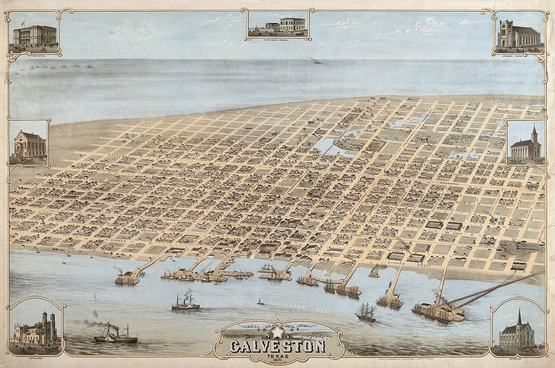
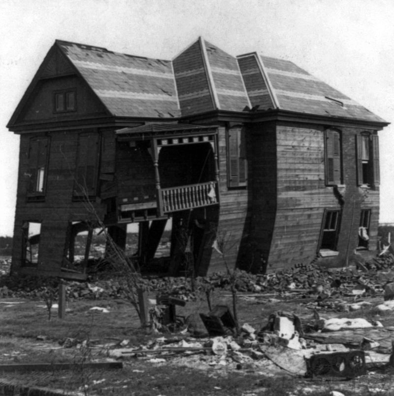
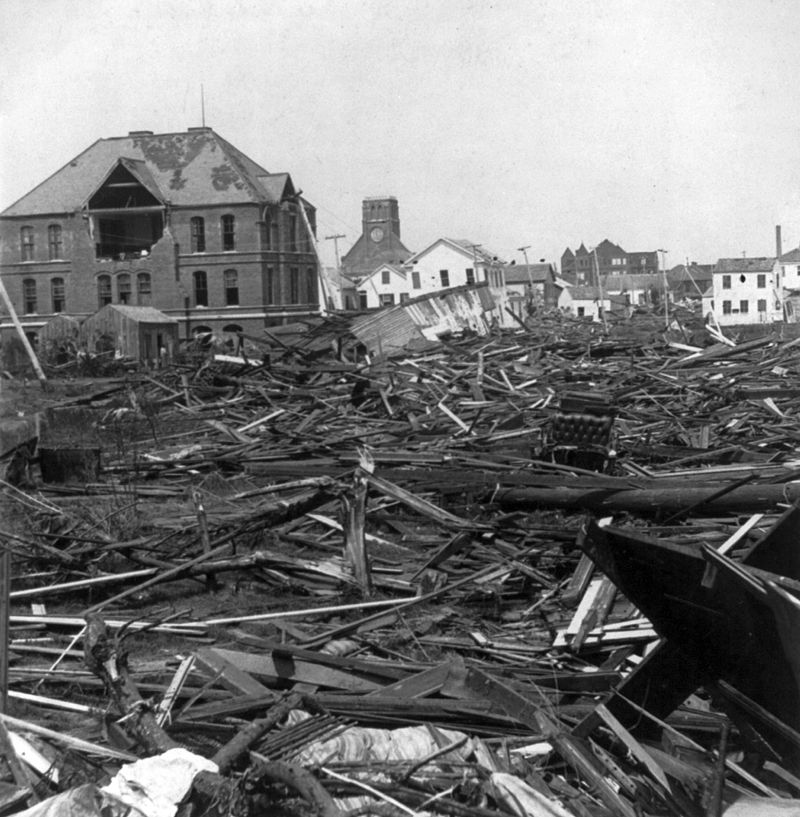
“Oh, my dear lord,” she exclaimed. There was nothing outside resembling in the least what had been there, a mere twenty-four hours before. The Richters’ garden – the lawn where the children had played – was a wilderness of shattered lengths of lumber, of whole small structures like outhouses and chicken coops tumbled together, trunks of palm trees like limp feather-dusters, and the bodies of dead horses. Not the two which had been left tethered on the front porch the night before – they were grazing moodily on those stretches of lawn now left exposed between the debris. Sophia also saw what she first thought to be bundles of clothes or bedding, and realized only slowly that they were bodies … bodies entangled in the rose-bushes, and in the hedges which enclosed Amelie’s garden. The water – which she could see had been nearly up to the second story of those scattered surviving buildings – had drained away. A few tall buildings and church spires still stood, and the occasional partly-shattered house, tottering on remaining pilings, or tipped entirely on one side. The sky overhead was a pale, rain-washed blue, and the desolation of broken boards, bodies and wrecked houses went nearly as far as they could see – to the north where lay the Strand, the wharves, and the significant buildings of Galveston.
“I must see if my friends are safe,” Richie said, huskily. Cousin George squinted into the distance.
“I think the Tremont is still standing,” he said. “They went there, did they not? And the Levy building remains.”
“But what is that?” Sophia asked. She crunched across the glass to the south-facing window, the one looking out towards the open gulf. A tangled moraine of wreckage ran from out of sight in one direction, dropping across the center of what had been neat rows of houses and gardens … a shoal of broken planks and wreckage on the near side … and a sweep of empty sand on the other. She blinked … Laura’s house was gone, the bright painted yellow walls and gallery vanished as cleanly as if they had never been, as if some great broom had swept the sea-front and several blocks behind it clean. Not a scrap remained, that she could seen save a bedraggled salt-cedar tree, which she thought had been at the corner of Q Street, three doors down.
“It’s is what the high sea brought last night,” Cousin George’s voice sounded heavy with grief. “Nearly the opposite of what happened in Indianola … there, the water rushed out from the bayou and pushed all out into the bay – here it smashed everything to pieces – and pushed it into land.”
“My dear friend Laura and her husband live on Q Street, not three blocks from the sea,” Sophia’s chest hurt, for thinking of her friend, and her three children – the oldest a boy two or three years older than Min – and that pretty little cottage that Laura had been so proud of.
“They may have chosen to shelter in a safer place,” Richie squeezed her hand, comfortingly. “We’ll go and look for them in a while. There are plenty of buildings still standing … they are certain to have sheltered as many as were safe here last night.”
He sounded very certain of that; looking out at the desolation, Sophia wondered how he could be so sure.


Recent Comments